In the world of aviation, there are many tools used to make air travel safe and accurate. One important tool is called VORTAC, which stands for VHF Omni-directional Radio Range, Tactical Air Navigation.
Even though it might seem complicated, we can break down and understand how VORTAC works. In this explanation, we’ll talk about what VORTAC is, what it does, what parts it has, how it works, and some new improvements in VORTAC technology used today.
Table of Contents
Understanding the Basic Definition of VORTAC in Aviation
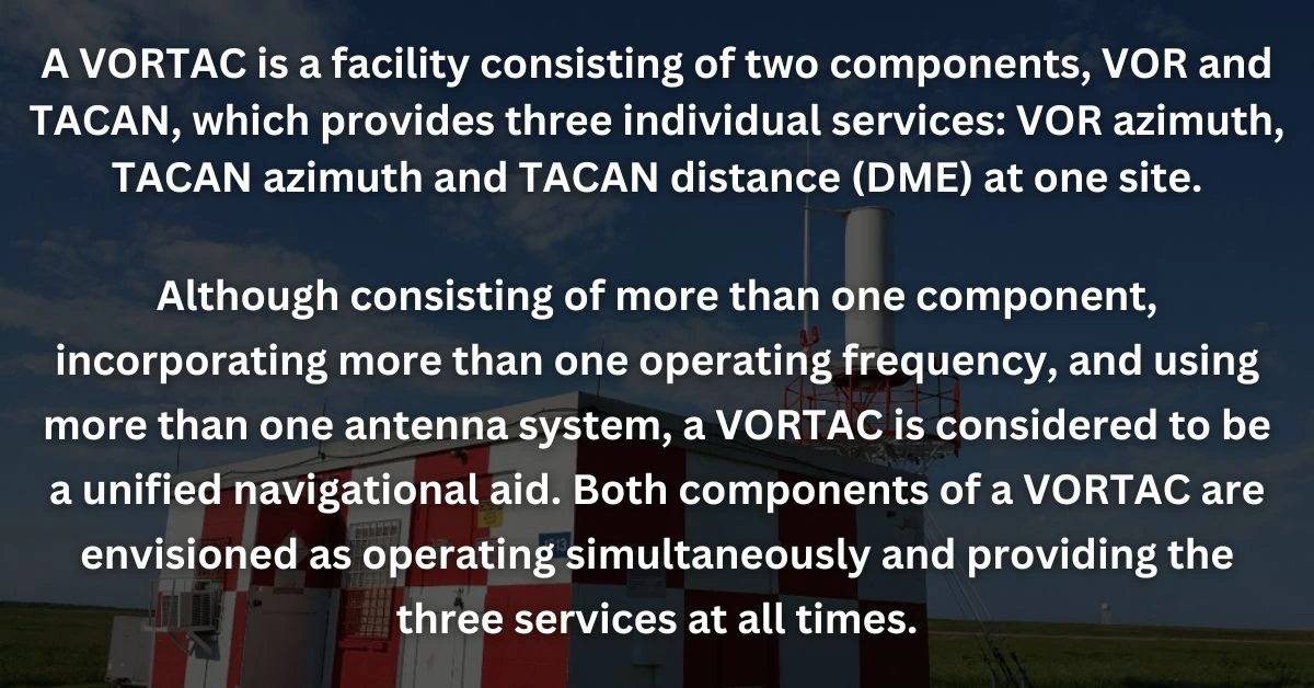
VORTAC stands for VHF Omni-Directional Radio Range, Tactical Air Navigation. It is a navigational aid that the aviation industry uses for both civilian and military aircraft. Essentially, VORTAC is a type of radio beacon that sends out signals in all directions (360 degrees) that pilots can tune into, to determine their aircraft’s bearing relative to the VORTAC station.
This system operates using two components – the VOR (VHF Omni-Directional Radio Range) and the TACAN (Tactical Air Navigation). The VOR provides the pilot with bearing information to or from the station, while the TACAN provides distance and bearing information. Together, they enable an aircraft to accurately pinpoint its position in the airspace, helping the pilot navigate from point A to point B.
Understanding VORTAC in Aviation Navigation
VORTAC, an essential system in radio navigation, plays a critical role in safe aviation. Despite the influx of more advanced technologies such as GPS in navigation measures, VORTAC remains an indispensable and dependable backup.
It’s noteworthy that VORTAC runs on Very High Frequency (VHF), thus its signals can be obstructed or hindered by physical barriers such as mountains. Consequently, for optimal functionality, it’s usually installed in elevated, unobstructed areas. Understanding how VORTAC works is crucial to gaining a comprehensive understanding of navigation in contemporary aviation.
Functionality of VORTAC
Understanding VORTAC in Aviation
VORTAC is an acronym encompassing two essential aspects of aviation navigation: VHF Omnidirectional Range (VOR) and Tactical Air Navigation (TACAN). This system is designed to offer bearing and distance information to aircraft from the station to guide their navigation. It is a dual system that caters to both military and civilian use, making this system beneficial in reducing redundancy.
The VOR aspect provides bearing data to an aircraft through phase comparison techniques; this feature allows planes to evaluate their position in relation to the VORTAC station, which plays a vital role in flight path accuracy.
Concurrently, the TACAN element offers distance information by tracing the delay amidst an interrogation signal and a response. The combination of these two functionalities allows the aircraft to pinpoint its exact airspace position accurately.
In the face of growing modernized technologies like GPS, VORTAC’s persistent reliability and necessity have cemented its importance in aviation navigation. Cross-checking GPS data with VORTAC data introduces a redundancy layer that further ensures the safety and dependability of flight procedures.
Components and Operation of VORTAC
Breaking Down the Components of VORTAC
VORTAC, which stands for VHF Omnidirectional Range and Tactical Air Navigation, is a pivotal system in aviation that bolsters navigation and communication. The VORTAC setup is primarily split into three fundamental components: the VOR (Very High-Frequency Omnidirectional Range), the TACAN (Tactical Air Navigation), and the DME (Distance Measuring Equipment).
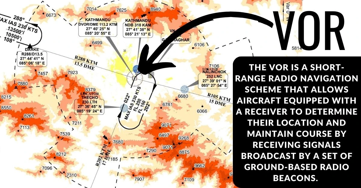
The VOR is a short-range radio navigation scheme that allows aircraft equipped with a receiver to determine their location and maintain course by receiving signals broadcast by a set of ground-based radio beacons.
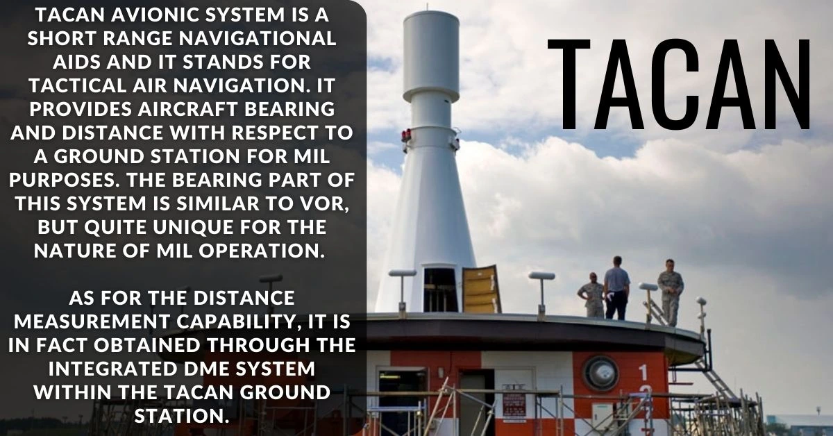
The TACAN segment, specifically crafted for military aircraft, provides bearing and distance data and operates in an extremely high-frequency range. Lastly, the DME provides the necessary distance metrics between the aircraft and the ground station by leveraging pulse timing methods.
Understanding the Functionality of VORTAC in Aviation
VORTAC is a comprehensive navigational support system in the realm of aviation, known for accurately providing aircraft position and course details to both pilots and air traffic control. In operation, the aircraft receives a radial from the VOR aspect of the VORTAC system – a distinct line radiating from the VORTAC station.
Through this radial line, a pilot can ascertain their aircraft’s bearing, which can then be cross-checked against other radials to accurately pinpoint the aircraft’s location.
Simultaneously, the TACAN component contributes by offering an azimuth reading. This reading essentially reflects the compass direction in which the aircraft is from the station. TACAN does not stop here; it additionally provides distance data to the plane, a function similar to the DME or Distance Measuring Equipment.
The DME calculates the time a signal takes to travel to and fro from the aircraft to the VORTAC station, thus determining the aircraft’s distance from the station. The amalgamation of this data brought together by VORTAC results in highly precise navigation, and consequently, proficient air traffic control and planning.
Modern Advances in VORTAC Technology
The Evolution and Advancements in VORTAC Technology
Initially, VORTAC systems were analog in nature, making them susceptible to errors, weather disturbances, and signal interference being the major culprits. However, with advancing technology, digital systems have been integrated into aviation navigation and have remarkably enhanced precision, decreasing the error margin of their analog counterparts. This digital transition has also ensured the reliability of these navigation systems, maintaining signal strength and accuracy even under unfavorable conditions.
The Federal Aviation Administration (FAA) alongside other global entities invests greatly in VORTAC system research, striving for constant enhancements. One main avenue of improvement has been in reducing the size of VORTAC equipment. Modern iterations of VORTAC systems are significantly more compact, reducing aircraft weight and saving space – a significant boon in small aircraft operations.
Looking into the future, it’s anticipated that VORTAC technology will further integrate with global navigation satellite systems (GNSS), such as GPS, GLONASS, and Galileo. This could potentially lead to robust hybrid systems amplifying the strengths of both ground and satellite-based technologies. Therefore, with its superior precision, reliability, and the prospect of advanced features on the horizon, VORTAC remains a vital component in Aviation Technology.
These improvements are not merely about enhancing flight path adherence. The principal objective of advancing VORTAC technology is to fortify safety measures and improve air travel efficiency. Given the current progression, it is anticipated that future VORTAC systems will continue making significant strides in achieving this goal.
As new technologies continue to emerge and enhance the world of aviation, VORTAC remains a reliable and integral component in aircraft navigation. From its role in establishing precise flight paths to its usage in both civil and military flights, this sophisticated system showcases the extraordinary progress in aviation technology.
By understanding the core components and functionalities of VORTAC, and the continuous strides being made in its technological advancements, a better appreciation is gleaned for the intricacies involved in making air travel precise and safe. The technology not only stands as a testament to the human ingenuity that propels aviation forward but also as a foundation from which future navigation technology can evolve.
Conclusion on ‘What is VORTAC in Aviation?’
In conclusion, the VHF Omni-directional Range/Tactical Air Navigation (VORTAC) is a crucial navigational aid in the world of aviation, seamlessly combining the capabilities of VOR (VHF Omni-directional Range) and TACAN (Tactical Air Navigation). This dual-functionality facility serves as a dependable guide for pilots, offering VOR azimuth, TACAN azimuth, and TACAN distance (DME) services all from a single location.
One of the key features that make VORTAC facilities stand out is the meticulous synchronization of VOR and TACAN transmissions. Pilots can trust that the signals they receive, whether using VOR azimuth or TACAN distance, are unequivocally originating from the same ground station. This synchronization ensures the accuracy and reliability that are paramount in aviation navigation.
Furthermore, the harmonious pairing of frequency channels between VOR and TACAN at each VORTAC facility follows a national plan. This thoughtful design simplifies operations for airborne crews, streamlining their use of these essential navigation aids.
In essence, VORTAC plays an indispensable role in enhancing aviation safety and efficiency. By offering a unified and synchronized navigational solution, it empowers pilots with the information they need to chart their courses accurately and navigate the skies with confidence.
As aviation continues to advance, the VORTAC system remains a steadfast and vital tool for pilots and air traffic controllers alike, contributing to the overall safety and precision of air travel.


