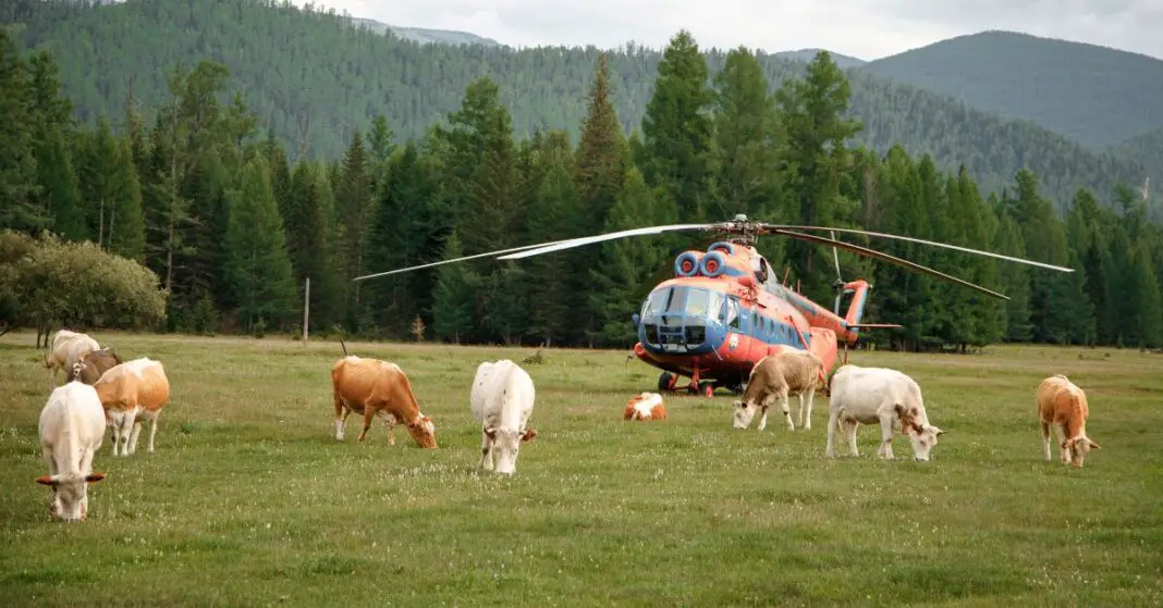
Ever wondered if helicopters can touch down just anywhere?
In this blog, we’ll explore the fascinating question: Can you land a helicopter anywhere? We’ll break it down in simple terms, uncovering the factors that determine where these flying machines can safely set down. Whether it’s about size, purpose, or location, let’s unravel the mysteries of helicopter landings together!
Table of Contents
Regulations Governing Helicopter Landing
If technology is our domain, then laws are programming codes that encourage order and governance. One question that seems to be on the dialogue surface in recent times is what exactly are the legal parameters governing where a helicopter can land? The answer isn’t as straightforward as downloading an app but we’ll explain this in the most digestible way.
Let’s start by acknowledging the crux of the matter. Federal Aviation Administration (FAA) regulations stipulate that a helicopter can land anywhere if the pilot has the permission of the property owner. Not complicated, right? But we are not leaving it just there.
This generalized ruling of the FAA, however, is subject to restrictions imposed by state, local, and other federal laws, like those set by the Environmental Protection Agency (EPA). This means, for example, in the case of environmental conservation areas, you can’t just land your helicopter there because it risks disrupting the ecosystem.
In cities or suburban areas, noise regulations come into play that could restrict helicopter operations to limit excessive noise caused by landing and takeoff.
Then there are case-specific regulations. Some zones such as schools, hospitals, and public events have established No-Fly Zones around them for safety and security reasons. You can’t land or even fly over these areas unless in emergency circumstances.
Physical Requirements for Helicopter Landing
Choosing the Right Helicopter Landing Spot: Physical and Environmental Considerations
Beyond the legal considerations, choosing a helicopter landing area is heavily dictated by the physical and environmental factors present. So let’s get right into understanding what calls for a careful selection of helicopter landing spots.
- Topography: A helipad by definition should be on flat, level ground which provides a reliable and stable area for landing. Contours and steep gradients are something to avoid. As aviation lovers, the importance of getting land surveys and topographical data should not be overlooked as these provide substantial insights about the feasibility of a site.
- Obstructions: Visual impediments like buildings, trees, power lines, poles, antennas, masts and such need to be significantly clear and be at a safe distance from the prospective landing area. The helicopter’s landing approach and take-off paths should be free of any obstructions, providing the pilot with a clear path to fly.
- Wind Direction: The cardinal rule here – is always take off and land into the wind. An area with large, open spaces is the ideal pick since these allow for efficient wind patterns, ensuring safety and operational reliability in different weather conditions.
- Ground Condition: The landing area must be stable with a tangible weight-bearing capacity. Landing on gravel or loose debris can hamper the landing process and cause damage. Tech enthusiasts would particularly enjoy the weight-bearing evaluations performed to calculate if the ground can service frequent helicopter landings.
- Size: Aptly put as “the bigger, the better,” the dimensions of the landing area is a key factor. Ensuring the land area is ample for the size of the helicopter wingspan, including additional space for piloting errors and safety margins is crucial.
- Access: Last, but not least – easy access for ground services and emergency vehicles, if required, is a significant consideration while choosing a landing spot.
Helicopter Landing Technology
Indeed, amid all the legal considerations and environmental constraints, technology emerges as a critical determinant of safe and effective helicopter landings. Technological advancements not only aid aviation professionals in navigating and piloting helicopters but also influence the selection of suitable landing sites.
Navigational technology plays an integral role. GPS systems have revolutionized land, sea, and air transport with their pinpoint accuracy. These systems can identify locations, forecast weather, measure altitude, and ascertain distances to selected landing sites. This specificity is invaluable for identifying landing sites aligned with all the legal, environmental, and safety aspects covered earlier.
Digital topography maps and Geographic Information Systems (GIS) illustrate landscapes with precision, highlighting elements like elevation, slopes, and terrain irregularities. This helps aviation professionals discern potential landing sites with optimal conditions. Similarly, satellite imagery provides real-time visual information about potential landing locations. It reveals details about the terrain, as well as any temporary obstructions that might have occurred post the most recent survey, such as fallen trees, new buildings, or event gatherings.
On-board sensors, meanwhile, can help determine wind direction and speed, essential variables for safe landings. High velocities or erratic gusts can complicate landings and pose safety risks; technology helps pilots determine if a location is suitable based on current wind conditions.
Drones have also entered the mix. Used for preliminary inspections, drones can capture high-resolution images and videos of potential landing zones, providing insights into obstructions, ground conditions, and the availability of open spaces.
Also critical is the land’s weight-bearing capacity, determined by technology. Insufficient ground strength can result in a collapsed landing zone and potentially catastrophic damage. Therefore, technology that tests the stability and bearing capacity of the ground is an essential tool in selecting landing zones.
Last but not least, helicopters need enough space to land and enable easy access for ground services and emergency vehicles. Technology aids in determining if the site’s physical dimensions fulfill these requirements, accounting for the helicopter’s rotor diameter, expected tilt, and safety buffers.
By facilitating better decision-making and providing pilots with invaluable data, technology doesn’t merely influence the choice of landing sites. It is the very backbone that ensures landing decisions align with safety, legal, and environmental guidelines, bringing an essential blend of efficiency and governance to the fast-paced world of aviation.
Whether a helicopter is tasked with emergency rescue, fire fighting, news coverage, or scenic tours, technology’s role is ceaseless and indispensable. As we navigate the 21st century, it’s not just about where you can land; it’s about where you can land safely and effectively, with technology guiding the way.
Emergency Helicopter Landings
Firstly, and most crucially, emergencies change the game substantially. While they follow strict rules in typical conditions, helicopter pilots are often granted latitude during emergencies. Firefighting efforts, medical evacuations, rescue operations – these scenarios may permit them to land in unconventional places, as long as they prioritize safety and minimize risk.
Secondly, helicopters can land quasi-anywhere if they’re in the service of law enforcement or military operations, again given that safety parameters are met. These professionals often need rapid deployment or extraction in a variety of terrains and contexts, making helicopters their go-to solution.
Talking about private lands, with express permission from landowners, pilots can use these as their landing zones. Picture it: a favorite trope in action movies with the billionaire making their grand appearance, landing their private chopper on a skyscraper helipad. This isn’t just Hollywood magic – it’s legal, with the right permissions in place.
But what technologies pave the way for these seemingly complex maneuvers? Technology, as it often does, steps up as a reliable ally for helicopter pilots. GPS systems, perhaps one of the most crucial pieces of equipment onboard, help in identifying potential landing sites.
Digital topography maps and Geographic Information Systems (GIS) also play a vital role. These tools provide data on the physical features of potential landing areas, enabling pilots to make informed decisions about whether it’s safe to descend.
Satellite imagery proves incredibly useful in these scenarios, too. It gives an aerial view of the area, presenting real-time information that can be crucial in emergencies or rapidly changing situations. Pilots can combine this imagery with their navigation skills and technology to choose the safest and most effective place to land.
Beyond maps and images, onboard sensors that determine wind conditions are another piece of cutting-edge tech. These sensors help assess the environment for elements that could potentially hamper a safe landing.
Can you land a helicopter anywhere USA?
Freely landing a helicopter in the USA is a non-starter. Despite the seemingly expansive skies, strict boundaries are in place due to FAA regulations, local laws, private property rights, and safety considerations. Picture it as requiring a passport and landing pad for each touchdown, with the weather playing the role of an unpredictable travel agent.
The only exception is in emergencies, where the imperative of a safe landing takes precedence over the rulebook. Therefore, unless you’re a pilot navigating emergency skies, it’s advisable to keep your feet firmly on the ground when exploring the USA by helicopter.
Do you need permission to land a helicopter?
Landing a helicopter isn’t as unrestricted as it may seem. Permission hinges on factors such as air traffic controllers, landowners, and local laws, turning each landing into a process akin to obtaining a sky passport.
Even public helipads may necessitate a conversation with air traffic control. The only exception lies in emergencies, where the imperative of a safe touchdown takes precedence over adhering to the rulebook.
Can you land a helicopter in a national park?
Helicopters are prohibited from flying in national parks across the USA. Touching down in these areas, unless it’s a rare emergency or park-related activity, is akin to disrupting a butterfly sanctuary with a bulldozer.
The National Park Service prioritizes the preservation of wildlife, tranquility, and visitor serenity, advocating for keeping helicopter rotors grounded. Instead, opt for public transportation, put on your hiking boots, or join a guided tour—thus contributing to the preservation of the park’s enchantment for future generations.
What are the requirements for a helicopter landing area?
The specifications for a helicopter landing area also referred to as a helipad, vary based on several factors. Firstly, the size of the helipad is influenced by the type of helicopter, with larger ones necessitating more significant landing areas. For instance, a medical helicopter might require a 30×30 ft pad, whereas a smaller news helicopter could make do with a 20×20 ft space.
Secondly, the purpose of the landing impacts the requirements; emergency landings may prioritize immediate availability and tolerate less clear surroundings, in contrast to planned landings for VIPs or cargo, which demand higher safety standards and accessibility.
Lastly, the location of the helipad matters, with public helipads at hospitals or airports adhering to stricter regulations compared to temporary landing zones in rural areas.
Also Read:
Can Helicopters fly in the rain?


