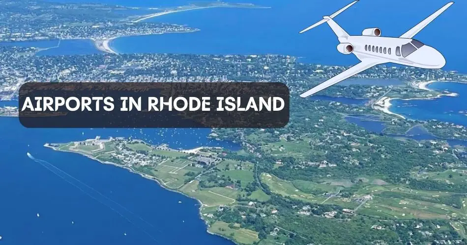
Rhode Island is a state in the New England region of the Northeastern United States. It is the smallest U.S. state in terms of both population, and area. This small state is famous for producing silverware, and fine jewelry.
Is Rhode Island actually an island? Though the name includes the word‘ Island’, Rhode Island is not an island.
Talking about transportation, Rhode Island can be accessed via highway or airway mediums. There are more than 7 airports in Rhode Island however, only one airport facilities regular commercial flights.
Explore All Airports in Rhode Island
Rhode Island is a small state, and features more than 7 airports including an international airport, and other general aviation airports.
Rhode Island T.F. Green International Airport is the major international airport that facilitates scheduled commercial flights. Quonset State Airport, Westerly State Airport, Richmond Airport, Newport State Airport, North Central State Airport, and Block Island State Airport are the other general aviation airports in Rhode Island.
Rhode Island T.F. Green International Airport (ICA: KPVD, IATA: PVD, FAA LID: PVD)
Rhode Island T.F. Green Int’l Airport (PVD) is the major international airport in Rhode Island which is owned by the State of Rhode Island, and operated by the Rhode Island Airport Corporation. The airport sits at an elevation of 55 ft (17 m) above mean sea level (AMSL), and serves Providence.
A total of 11 airlines operate commercial passenger flights to and from T.F. Green Airport connecting to various major domestic destinations across the United States.
PVD Runway Information
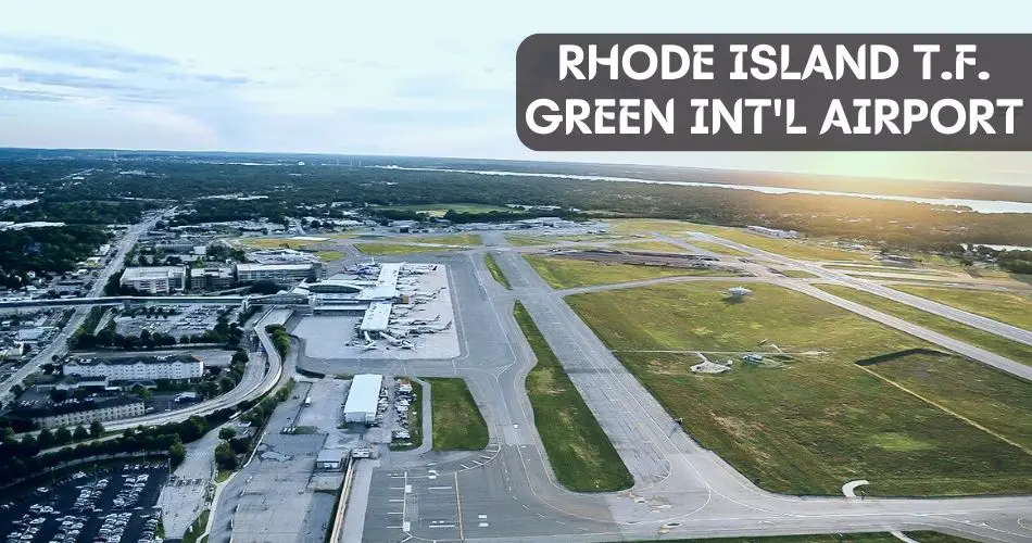
T.F. Green Airport covers a total area of 1,111 acres (450 ha), and features two runways with the designations Rwy 5/23, and Rwy 16/34. The Runway 5/23 is 8,700 ft (2,652 m) long whereas the Rwy 16/34 is 6,081 ft (1,853 m) long.
| RUNWAY DESIGNATION | LENGTH | SURFACE |
| Rwy 5/23 | 8,700 ft (2,652 m) | Asphalt |
| Rwy 16/34 | 6,081 ft (1,853 m) | Asphalt |
PVD Terminal Facility

Rhode Island T.F. Green Int’l Airport is equipped with a single passenger terminal featuring two concourses (North, and South). There are a total of 22 gates; 8 gates in the South Concourse, and 14 gates in the North Concourse.
All terminal facilities including airline check-in counters, TSA security checkpoint, and departures are available on the upper level of the passenger terminal. Likewise, the lower level offers arrivals, and baggage claim services.
Other terminal amenities include dining, shopping, washrooms, ground transportation, and so on.
Airlines and Destinations
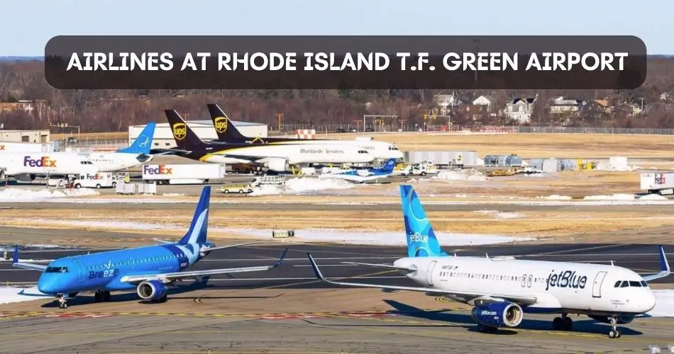
11 domestic airlines operate scheduled commercial flights to and from T.F. Green Int’l Airport. Allegiant Air, American Airlines, Breeze Airways, Delta Air Lines, Frontier Airlines, JetBlue, Southwest Airlines, Southern Airways Express, Sun Country Airlines, and United Airlines are the major airlines operating at PVD. Air Canada used to connect Toronto with Rhode Island however, this international flight is currently suspended.
| OPERATING AIRLINES | DESTINATIONS |
| Air Canada | Toronto (Currently Suspended) |
| Allegiant Air | Cincinnati, Nashville, and Punta Gorda/Ft. Myers |
| American Airlines | Charlotte, Chicago–O’Hare, Miami, Philadelphia, and Washington Reagan National |
| Breeze Airways | Charleston, Columbus, Jacksonville, Los Angeles, New Orleans, Norfolk, Pittsburgh, Richmond, and Savannah |
| Delta Air Lines | Atlanta, Detroit, Minneapolis St. Paul, and New York–LaGuardia |
| Frontier Airlines | Atlanta, Denver, Ft. Lauderdale, Orlando, and Raleigh-Durham |
| JetBlue | Ft. Lauderdale, Orlando, and West Palm Beach |
| Southwest Airlines | Baltimore, Chicago–Midway, Ft. Lauderdale, Ft. Myers, Orlando, Tampa, Washington Reagan Nationa, and West Palm Beach |
| Southern Airways Express | Nantucket |
| Sun Country Airlines | Minneapolis/St. Paul |
| United Airlines | Chicago–O’Hare, Newark, Washington Dulles |
PVD Technical Information
| ICAO CODE | KPVD |
| IATA CODE | PVD |
| FAA LID | PVD |
| ELEVATION | 55 ft (17 m) |
| AREA | 1,111 acres (450 ha) |
| RUNWAY | 5/23 (8,700 ft) 16/34 (6,081 ft) |
Block Island State Airport (ICAO: KBID, IATA: BID, FAA LID: BID)
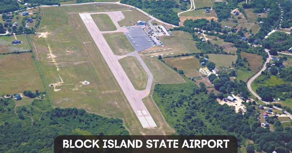
Block Island State Airport (BID) is one of the public-use airports in Rhode Island that is owned by the State of Rhode Island, and operated by the Rhode Island Airport Corporation. This airport primarily focuses on general aviation activities but you can also witness commercial passenger flights to Westerley Airport, and Bethany’s DIner.
BID Runway Information
BID sits at an elevation of 108 ft (33 m), and serves Rhode Island, and Block Island. It covers a total area of 136 acres (55 hectares), and features a single asphalt runway with the designation 10/28.
| RUNWAY DESIGNATION | LENGTH | SURFACE |
| Rwy 10/28 | 2,502 ft (763 m) | Asphalt |
Airlines and Destinations
As we discussed above, Block Island State Airport primarily serves as general aviation airport. New England Airlines (an airport-based tenant at BID) operates flights to Westerley Airport, and Bethany’s Airport Diner. New England is an 8-passenger commuter airline.
| OPERATING AIRLINE | DESTINATION |
| New England Airlines | Westerly, and Bethany’s Diner |
BID Technical Information
| ICAO CODE | KBID |
| IATA CODE | BID |
| FAA LID | BID |
| ELEVATION | 108 ft (33 m) |
| AREA | 108 ft (33 m) |
| RUNWAY | 10/28 (2,502 ft) |
Newport State Airport (ICAO: KUUU, IATA: NPT, FAA LID: UUU)
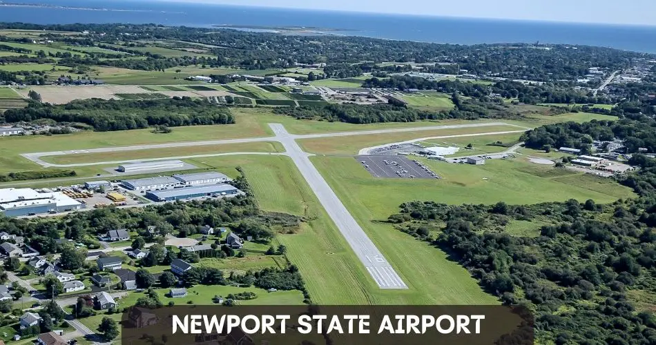
Newport State Airport (UUU) is also among the public-use airports in Rhode Island that serves Newport, Rhode Island. It is owned by the State of Rhode Island, and operated by the Rhode Island Airport Corporation.
UUU is situated at an elevation of 171 ft (52 m) above mean sea level (AMSL), and covers a total area of 221 acres (89 hectares). It features two asphalt runways with the designations Rwy 4/22, and Rwy 16/34.
| RUNWAY DESIGNATION | LENGTH | SURFACE |
| Rwy 4/22 | 2,999 ft (914 m) | Asphalt |
| Rwy 16/34 | 2,623 ft (799 m) | Asphalt |
UUU Technical Information
| ICAO CODE | KUUU |
| IATA CODE | NPT |
| FAA LID | UUU |
| ELEVATION | 171 ft (52 m) |
| AREA | 221 acres (89 hectares) |
| RUNWAY | Rwy 4/22 (2,999 ft) Rwy 16/34 (2,623 ft) |
North Central State Airport (ICAO: KSFZ, IATA: SFZ, FAA LID: SFZ)
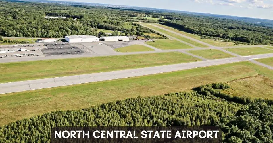
North Central State Airport (SFZ) is also one of the public-use airports in Rhode Island that is situated at an elevation of 441 ft (134 m) above mean sea level (AMSL). It is categorized as a local general aviation facility.
SFZ covers a total area of 475 acres (192 hectares), and features two asphalt runways with the designations Rwy 5/23, and Rwy 15/33.
| RUNWAY DESIGNATION | LENGTH | SURFACE |
| Rwy 5/23 | 5,000 ft (1,524 m) | Asphalt |
| Rwy 15/33 | 3,210 ft (978 m) | Asphalt |
SFZ Technical Information
| ICAO CODE | KSFZ |
| IATA CODE | SFZ |
| FAA LID | SFZ |
| ELEVATION | 441 ft (134 m) |
| AREA | 475 acres (192 hectares) |
| RUNWAY | Rwy 5/23 (5,000 ft) Rwy 15/33 (3,210 ft) |
Quonset State Airport (ICAO: KOQU, IATA: NCO, FAA LID: OQU)
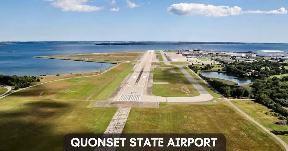
Quonset State Airport (OQU) is a public and military use airport located in Rhode Island. The airport is situated at an elevation of 18 ft (5m) above mean sea level (AMSL).
OQU covers a total area of 754 acres (305 hectares), and features two asphalt runways with the designations Rwy 16/34, and Rwy 5/23.
| RUNWAY DESIGNATION | LENGTH | SURFACE |
| Rwy 16/34 | 7,504 ft (2,287 m) | Asphalt |
| Rwy 5/23 | 4,000 ft (1,219 m) | Asphalt |
OQU Technical Information
| ICAO CODE | KOQU |
| IATA CODE | OQU |
| FAA LID | OQU |
| ELEVATION | 18 ft (5 m) |
| AREA | 754 acres (305 ha) |
| RUNWAY | Rwy 16/34 (7,504 ft) Rwy 5/23 (4,000 ft) |
Westerley State Airport (ICAO: KWST, IATA: WST, FAA LID: WST)
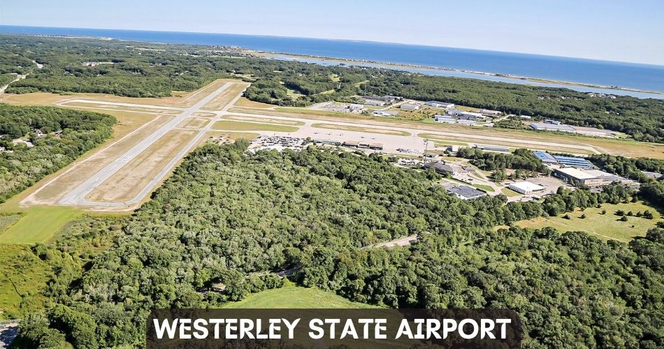
Westerley State Airport (WST) is also one of the public use airports in Rhode Island that is owned, and operated by the Rhode Island Airport Corporation. It is situated at an elevation of 81 ft (25 m), and serves the Westerly region.
WST is a general aviation airport that is categorized as a non-hub primary commercial service facility. New England Airlines (an 8-passenger commuter airline) offers commercial service to Block Island State Airport.
The airport covers a total area of 321 acres (130 hectares), and features two asphalt runways with the designations Rwy 7/25, and Rwy 14/32.
| RUNWAY DESIGNATION | LENGTH | SURFACE |
| Rwy 7/25 | 4,010 ft (1,222 m) | Asphalt |
| Rwy 14/32 | 3,960 ft (1,207 m) | Asphalt |
WST Technical Information
| ICAO CODE | KWST |
| IATA CODE | WST |
| FAA LID | WST |
| ELEVATION | 81 ft (25 m) |
| AREA | 321 acres (130 ha) |
| RUNWAY | Rwy 7/25 (4,010 ft)Rwy 14/32 (3,960 ft) |
Closest International Airport to Rhode Island
Boston Logan International Airport (BOS), and Bradley International Airport (BDL) are the two closest international airports to Rhode Island. Other nearby international airports include Portland International Jetport (PWM), LaGuardia (LGA), and John F. Kennedy International Airport (JFK).
| NEARY INT’L AIRPORTS | DISTANCE FROM RHODE ISLAND | ESTIMATED DRIVING TIME |
| Boston Logan International Airport (BOS) | 72.5 miles | 1 hour 18 minutes |
| Bradley International Airport (BDL) | 88.1 miles | 1 hour 34 minutes |
| LaGuardia Airport (LGA) | 160 miles | 2 hour 51 minutes |
| John F. Kennedy International Airport (JFK) | 165 miles | 3 hours |
| Portland International Jetport (PWM) | 174 miles | 2 hours 52 minutes |
Conclusion
We discovered all the airports in Rhode Island with the airport information, airlines & destinations, technical details, and much more.
Rhode Island T.F. Green International Airport (TVD) is the only international airport in Rhode Island that is served by a total of 11 airlines. The major domestic carriers connect TVD with various destinations across the United States. The international flight to Toronto operated by Air Canada from TVD is currently suspended. Other airports in Rhode Island are made for general aviation purposes.
You can also choose to land at nearby international airports (BOS or BDL), and reach Rhode Island via highway drive.
FAQs on Airports in Rhode Island
How many airports does Rhode Island have?
There are 6 airports in Rhode Island out of which T.F. Green Airport is the only international airport while the other airports are categorized as general aviation facilities.
What airport do you fly into Rhode Island?
Rhode Island T.F. Green International Airport (TVD) is the best airport to fly to Rhode Island as it is served by a total of 11 airlines connecting various domestic destinations.
What is the closest major airport to Rhode Island?
The closes major airport to Rhode Island is Boston Logan International Airport (BOS) which is 72.5 miles away.
What airlines fly out of Rhode Island?
Allegiant Air, American Airlines, Breeze Airways, Delta Air Lines, Frontier Airlines, JetBlue, Southwest Airlines, Southern Airways Express, Sun Country Airlines, and United Airlines fly out of Rhode Island. The international flight to Toronto, Canada operated by Air Canada from Rhode Island is currently suspended.


